Category
- Mountain View
KANTO
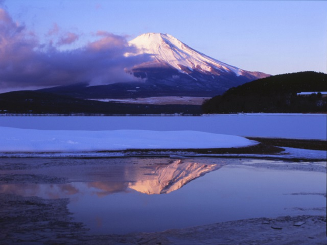
Mount Fuji is the most-loved mountain by the Japanese,it has been affecting Japanese cultures deeply since the old days with pictures,that is to say, it is the symbol of Japan.The beautiful mountain can be seen from Tokyo on a fine day or can be seenon the way of the Tokaido Shinkansen from Tokyo to Kyoto.It is also a famous volcano which was recently designated as the World Natural Heritage.◆Offi...
HOKKAIDO
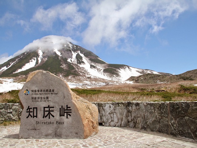
Shiretoko Pass is a mountain pass of 738 meters above sea level which connects Utoro town to Rausu town.The mountain pass is also an attractive driving course.The sight of the remaining snow at the end of July is very impressive.Furthermore, colored leaves of Mt.Rause (Rausu-dake) seen from the pass are wonderful. ...
HOKKAIDO
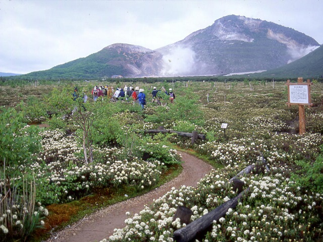
Mt. Iozan is located between Lake Kussharo and Lake Mashu, its entire mountain is made of sulfur.Smoke of sulfur makes a sound with roar and goes up here and there on the mountain.Tourists may experience the beating of the active volcano.Some trails are available to walk around the mountain.Kawayu-onsen or Kawayu Hot Spring resort is nearby, and a lot of accommodation with the sulfur hot water.Kaw...
HOKKAIDO
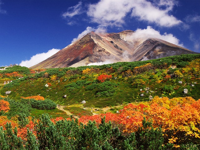
Mount.Asahidake is the highest peak(2290 meters) of the Daisetsu area, and a symbolic volcano.Tourists can easily reach the observatory by Ropeway.There are some small ponds at the end of the Ropeway, they can provide with a scenic-viewing road.The mountainous beauty of the large volcanoes can be enjoyed. It takes two hours to climb to the mountaintop.The prospects seen from the mountaintop are in...
TOHOKU
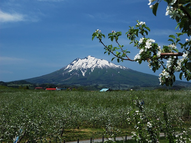
Mt. Iwaki is a volcano of 1625 meters above sea level which is the support of the people of Hirosakiand the target of worship since a long ago just as Mount Fuji, on the top of which is Iwakisan Shrine.The mountain is seen from anywhere of Hirosaki.The beautiful mountain is called Tsugaru Fuji.Get a shuttle bus to ‘8-gome’ stop, then a lift takes to 9-gome, so it takes totally 45 minutes to climb ...
TOHOKU
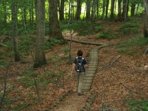
The trail is called Mini Shiragami through which people will easily know the beech forest of World Heritage.Tourists have a walk in the beech forest easily.It is specially recommended to those tourists who want to have visit to the beech forest. ...
TOHOKU
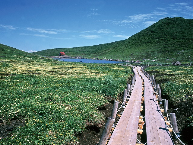
Mount Akita Komagatake is a volcano by Lake Tazawa ,there is a parking lot on 8- gome of the mountain(Because of the road regulations, it is not available for vehicles except buses during the daytime),and it takes 1 hour to reach the mountaintop from the parking lot.There are many alpine plants, and the view of Lake Tazawa seen from the mountaintop is really splendid.It is better on a fine day ...
TOHOKU
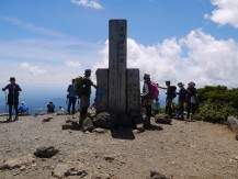
There are various trails to the mountaintop, yet, on the Sukawa-kogen( Highlands) in the middle,it is better to choose 4.5-hour trail (Ascent: 2.5 hours Descent: 2 hours )during which visitors stay at 2 lodging facilities of the Sukawa -kogen .If you can get to the start of the mountain trail by car,the easiest spot to the top is Iwakagamidaira in Miyagi Prefecture , it is a 2.5-hour trail. ...
KANTO
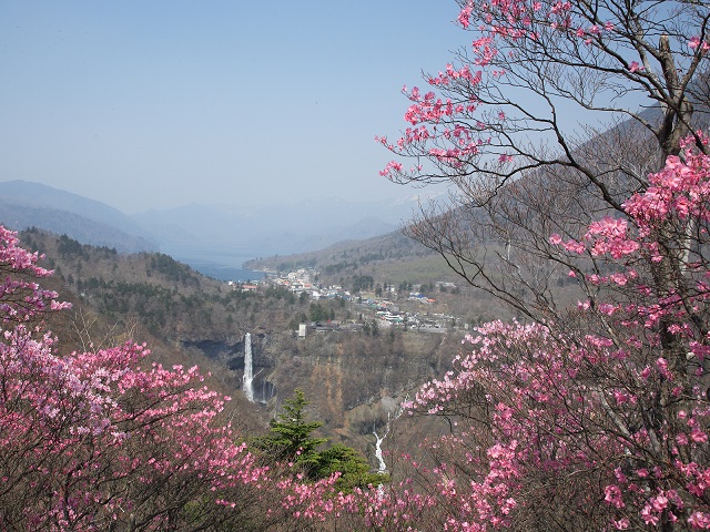
It is in the middle of the way from Nikko downtown to Lake Chuzenji , on which Mount Nantai, Lake Chuzenji ,Kegon Waterfall can be seen.Get there from the parking lot by cable car.Yet, the scenery changes depending on the weather, so fine days are recommended to climb....
KANTO
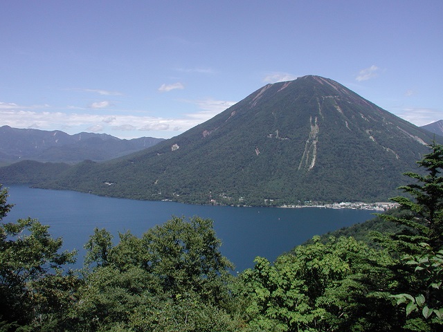
The mountain is located in the southern bank of Lake Chuzenji ,and the view of Mount Nantai and Lake Chuzenji seen from the Observatoryis the best spot of view around the Lake Chuzenji ....
TOHOKU
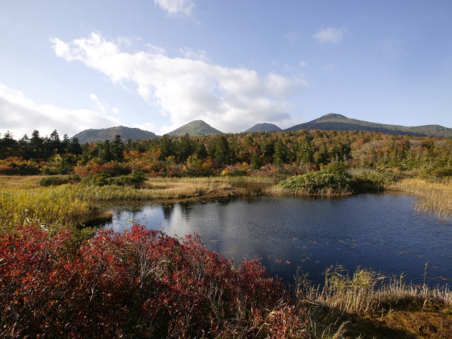
Ropeway Station is in the middle toward the Sukayu hot spring from the Aomori cityand it is a large panorama to be able to look around from mountaintop Station observatory to the Gulf of Mutsu.There are the hiking course in colored leaves,and it is a popular skiing area in Aomori becase deep snow ski of the winter rime on trees, a backcountry and various slopes.The rime on trees of the winter skii...
CHUBU
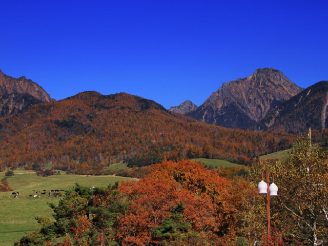
Kiyosato-kogen is the biggest resort of Mount Yatsugatake located at the southern foot of the highlandin the Mountain Yatsugadake area.As a summer resort with many accommodations and restaurants in the highland area,there are many dude ranch activities here and there....
CHUBU
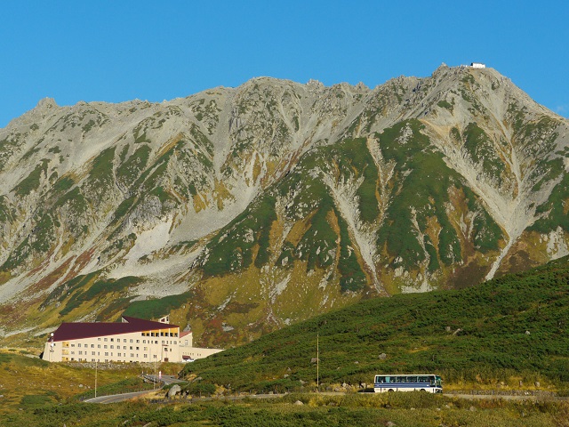
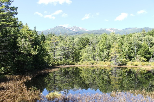
Murodo is a plateau of 2450 meters above sea level on the way of Tateyama-Kurobe Alpine Route,and the basic spot getting to Kurobe Dam, Mountain climbing and hiking, and there are some accommodations.Magnificent mountains of 3000 meters high can be seen in front of the eyes.There are some beautiful marshes in the neighborhood where tourists can feel the superb viewand the splendor of nature. ...
CHUBU
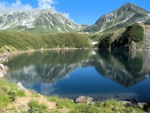
Mikurigaike is the most beautiful crater lake in the Northern Alps region , located a 10-minute walk awayfrom the Murodo bus terminal with 600 meters around and 15 meters deep.It is clearly transparent, and on the surface of the legendary lake,what is splendid is that the majestic figure of the mountains of 3,000 meters high is projected....
HOKKAIDO
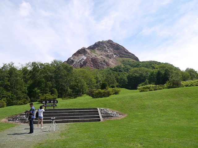
M.t Showa-shinzan is a new volcano which formed in 1943 with a dome shape and 290 meters above sea level.Shinzan means a new mountain.People observed the process it formed as it erupted in center of the field, so that is why it attracts the world.Even now people can see the gas erupting from it....
HOKKAIDO
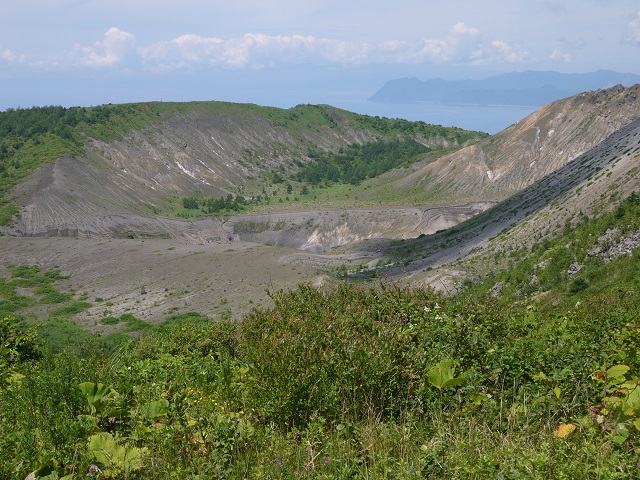
Mt.Usu is an active volcano which erupts once in several decades .Mt.Showa-shinzan is a mountain which is formed at the foot of Mt.Usu, so we may say it a part of Mt Usu.Tourists may reach the top of the mountain by ropeway from the station with parking lotsand have a panoramic view of Lake Toya and the mountain from the observatory tower.It takes ten minutes to walk from the mountain-top station ...
Tenjindaira of Mt.Tanigawadake
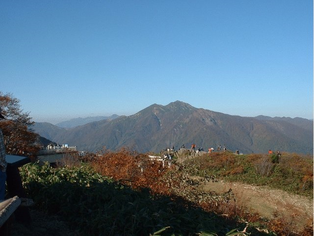
KANTO
Mt. Tanigawadake is a mountain area 2000 meters long in Gunma Prefecture and Niigata Prefecture,and famous for its grand view seen from the mountain ridge.Tenjindaira is an observatory 1500 meters high, where the mountaintop of Mount Tanigawadake and grand mountainscan be seen panoramically.It is easy to get by ropeway from the foot. It is full of skiers in winter as a skiing area.It is the popula...
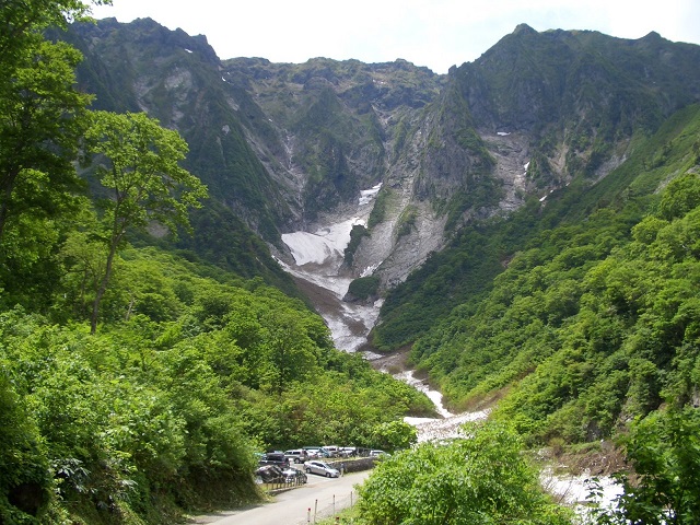
KANTO
Ichinokurasawa is the popular of the Japanese rock climber with steep vast rock cliffs of Mt.Tanigawadake.The difficulty of climbing it is well-known among climbers in the world, so it is called the dangerous cliffwhere there are the most number of victims.The scene here is hard to express in words. Ridges rising above mountains, frequently-changing rock cliffs,snowy valley are all the overwhelmin...
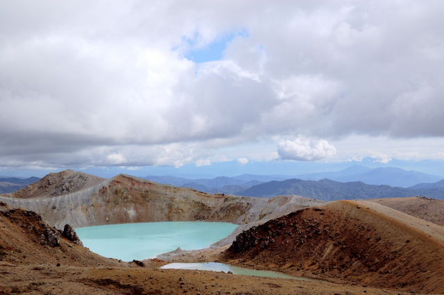
KANTO
It is a volcano of 2160 meters located in the border with Nagano Prefecture with a beautiful crater lake on the mountaintop.Many different hiking trails around the mountain area are available,and a large number of alpine trees make hikers pleasant.Yet, the hiking is now prohibited by the volcanic activity....
CHUBU
It is located at the north end of Mount Yatsugatake,the Alpine view seen from the mountaintop station of 2237 meters above sea level is perfectly magnificent.In the Tsuboniwa Nature Garden on the mountaintop,the scene that shrubs cover the lava plateau and the nature that alpine plants grow in colonies is splendid.There is a trail for approximately 30 minutes one round.It is the skiing area in win...
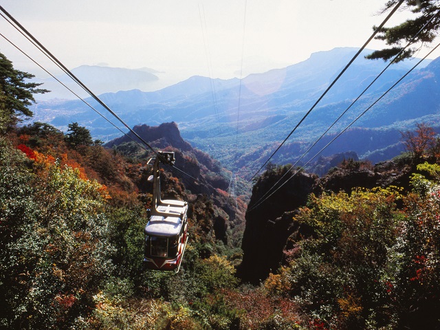
SHIKOKU
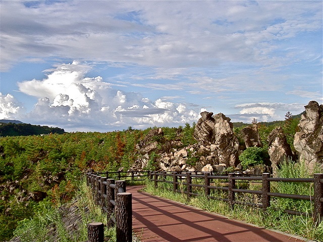
Kankakei is a valley of 7 km long from the east to the west, 4 km long from the north to the south,located in the central part of Shodoshima Island.The cliffs and strangely-shaped rocks were formed by the rocks eroded by crustal movementand by wind and rain repeatedly, accumulated by the volcanic activity 13 million years ago.It is the splendid highlight even seen from the observatory....
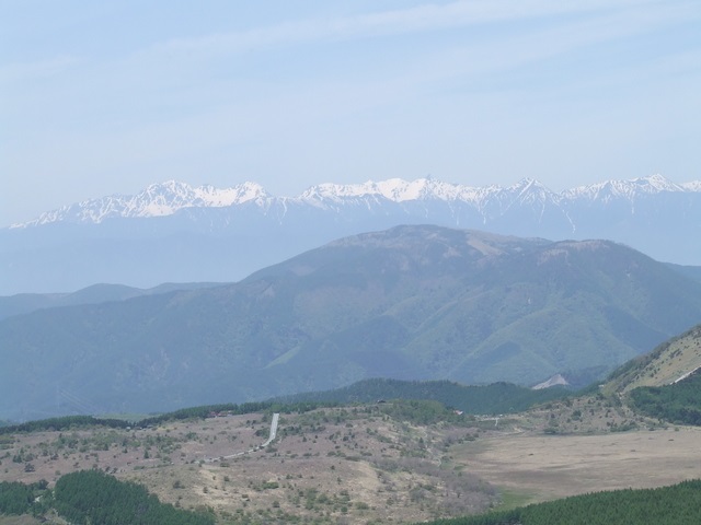
CHUBU
It is a well-known mountainous driving route of 75 km from Chino City to Matsumoto City,which passes the flower garden of the plateau with the great mountain as its back.Tourists can enjoy various sceneries such as a quiet plateau, alpine plants and marshlands.Enjoying flowers is in the period from June to September,while seeing red leaves is from the beginning of October to the middle of October....
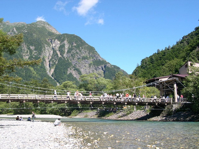
CHUBU
Kamikochi is a well-known place to see autumn colors, the base for advanced mountain climbers,and hiking routes.Kappabashi Bridge goes over the snow-melt river the mountain in Kamikochi,and there is an attractive view of the mountainsfrom this bridge.There are mountain climbing and a hiking map available at the information booth of the Matsumoto JR station.There are few hotels around there. &...
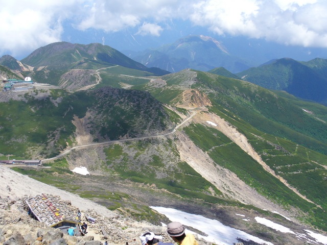
CHUBU
Mount Norikura is an active volcano(3,026m height) a very broad skirt.You can enjoy a magnificent view from the mountaintop.The mountaintop can be reached around a 1 hour 30 minute-walk on the trail from “Tatamidaira”which is the highest bus route of Japan (2700m).Although the mountaintop is over 3,000m high,it is known to be easier to climb than other Japanese 3,000m mountains. ...
CHUBU
Norikura-kogen is the hillside of Mount Norikura.It is well known as summer resorts, climbing and hiking activities, autumn color viewing, and ski resorts.There are also many onsen resorts around there, so many tourists visit for bathing only....
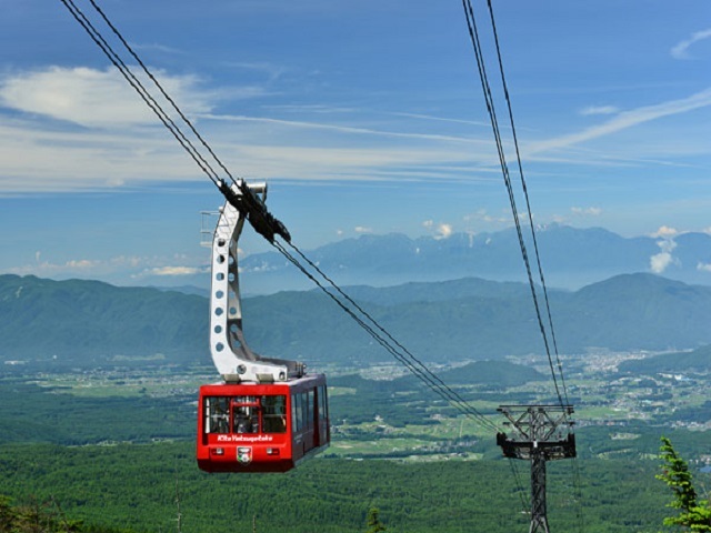
CHUBU
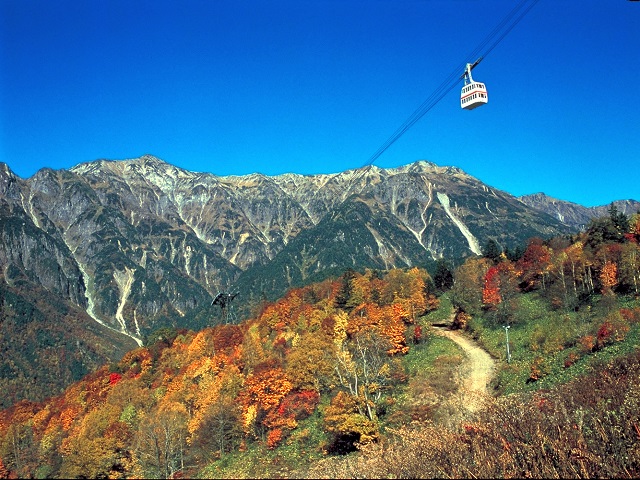
Shinhodaka Ropeway is the only Japanese double decker gondola to enjoy superb viewat more than 2,000m above sea level.The observatory of the summit is on above of Nishihotakaguchi Station 2,156m above sea level.The vast Alps mountain panorama of 360 degrees can be enjoyed.It is a highlight of the Northern Alps....
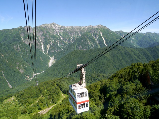
CHUBU
Mt. Hotaka area is the representative mountains of 3000 meters high in the Northern Alps,and the mountain views from an observatory of 2,200meters above sea levelto get by ropeway are really panoramic. ...
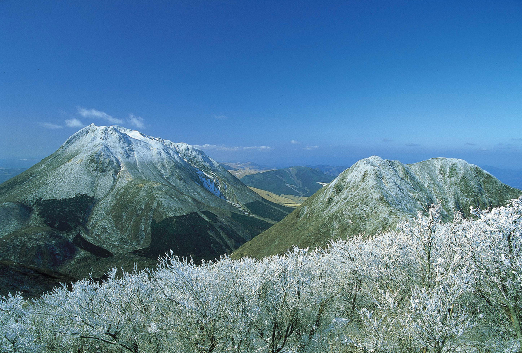
KYUSHU
It is located on the top volcanic Mount Tusrumi in the west of Beppu City with 1375 meters of sea level.It is accessible by cable car, and the view seen on it is panoramic....
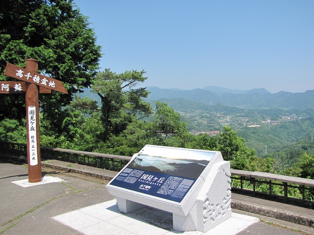
KYUSHU
Kunimigaoka is a hill of 513 meters above sea level, and the prospects of Takachiho Gorgeand the neighboring mountains are wonderful,especially the sea of clouds is so famous that photograph lovers like to visit and take photographs....
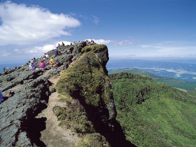
KYUSHU
It is the highest mountaintop above 1700 meters sea level among the Kirishima Mountainsand there is a big crater, when rain continues to fall, the lake of the crater appears.The views in the middle of mountain trail or on the mountaintop are great,and it is very popular because climbers start from the mountain trail near the Eco Museumand spend only one and a half hours in reaching the mountaintop...
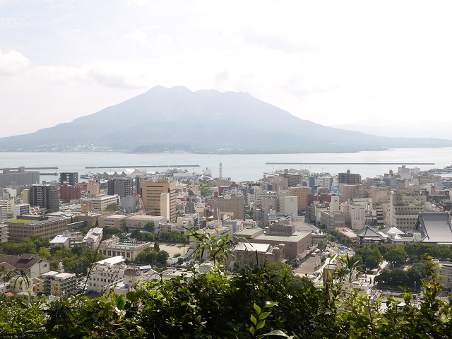
KYUSHU
Shiroyama Observatory is on a small hill of 100 meters sea levelwhere the downtown of Kagoshima City and Sakurajima Island can be seen perfectly....
KYUSHU
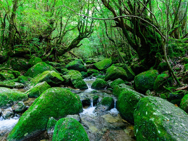
It takes 5 to 6 hours to have a round-trip trail.Tourists may feel the powerful charm of the rock and mossed primitive forest by walking along the streamin the forest of the Yaku cedars, which is really a highlight trail.Though it is not a difficult trail, it may be a long-walk trail if it is not confirmed.Taikoiwa is a superb view prospect spot of the beauty of mountain areas in Yakushima,and it ...
KYUSHU
Yakesugi Land has 4 courses(30minutes, 50 minutes, 80 minutes, 150 minutes).The 30-minute trail and 50-minute one are light cycling trail,there are recommended to the visitors who want to experience the forest a little.Because a trail is built and the atmosphere of the forest of Yakushima can be enjoyed,these two trails are recommended to those who have no time or lack physical strength.80-minute ...
OKINAWA
Because it is in the northern mountainous area, tourists can see the thick subtropical jungle, primitive natural sceneryand feel that the nature is magnificently splendid.A great variety of animals and plants inhabit here and participating in an eco-tour to go aroundthe northwest of Ishigaki Island is recommended because there are a lot of tour companies handling a river kayak.In case you cannot ...
OKINAWA
Miyara River is the biggest river on the island flowing through the southern part of Ishigaki Island.A lot of natural riverbanks remain, and plants grow well on the mangrove damp ground in the lower area of the riverand it is designated as the natural monument of the country as "Plant Forest of the Miyara River”.In addition, in recent years the tour by canoe extends to the river entrance.You may h...
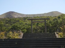
KYUSHU
The summit of Mount Takachihomine isthe legend site in the creation mythology of Japan.Ninigino- Mikoto is said to create the lineage of Japanese Emperors.It was here that Ninigi-no- Mikoto is said to have descended to earthfrom heaven.His fabulous swardstill remains there.There is the mountain entrance in Takachihogawara....
KYUSHU
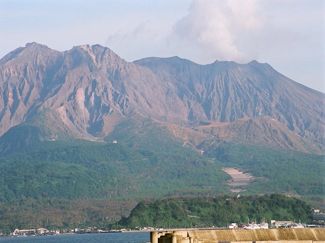
Sakurajima Island is a volcanic island located on the opposite shore of Kagoshima Bay facing with Kagoshima City,whose circumference is about 55 km.It was an island literally, but was connected with a peninsula by the eruption of the volcano in1914.Ferries leave Kagoshima Port for the Island frequently and a lot of visitors come to watchthe figure of the raw, active volcano and the beautiful mount...
KYUSHU
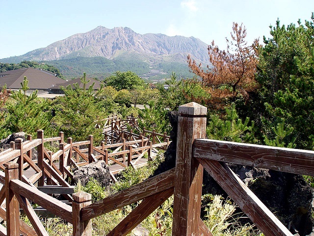
Arimura Lava Observatory is located at the southern foot of Sakurajima Islandwhich was made on the lava field of 1914 in Arimura Village.Lava field opening to one side and black pine setting on roots on the lava create a unique scenery.There is a promenade of approximately 1km in total length, and not only the lava but also the view is splendid.A different Sakurajima will be seen from here, a comb...
KYUSHU
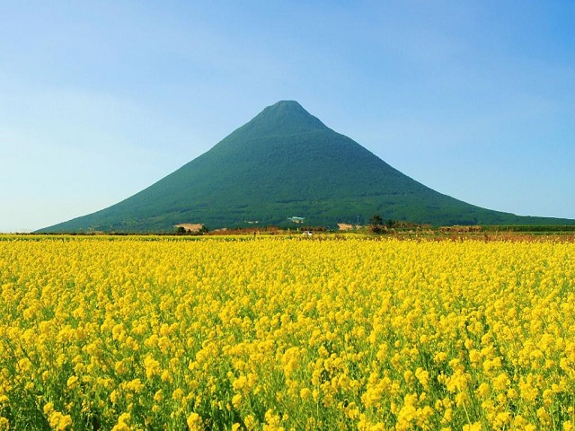
Mount Kaimondake is located at the south end of the Satsuma Peninsula in Kagoshima,which is a volcano of 924 meters above sea level.It becomes the volcanic body directly from the sea, and it is also called another Satsuma Fujifor its wonderful conic image of mountain.The beautiful mountain can be seen from different parts of the Satsuma Peninsula.The silhouette shining in the sunset is particularl...
KYUSHU
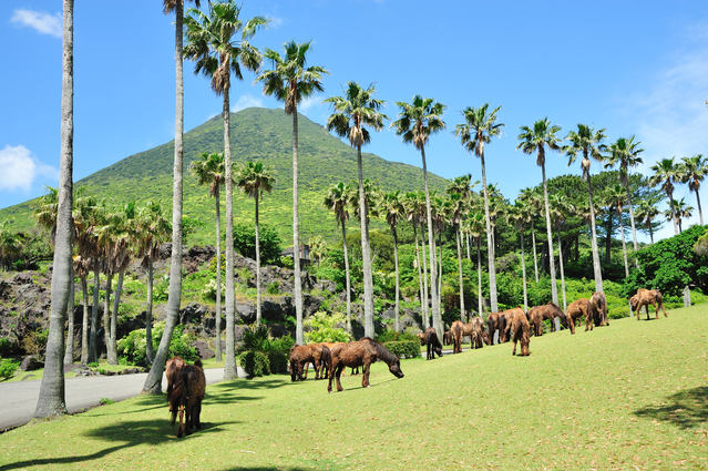
It is a very large natural park spreading out to the eastern foot of Mount Kaimondakewhere the view of Nagasaki Nose is great, and though there are botanical gardens of tropical and subtropical plants,the most impressive is that Tokara horses which are said to be the progenitor of Japanese horses have a leisure time.Generally speaking, the Japanese horses are small and quiet, yet on seeing the hor...
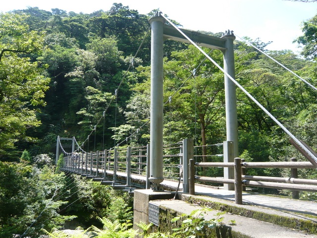
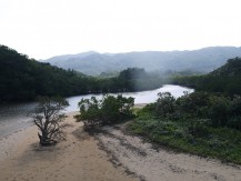
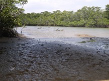
Nakama River Nature Reserve Area
OKINAWA
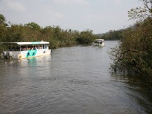
Nakama river flows through the east side of Iriomote and is proud of about 12 km long,a scale of basin area of 32.3 square km, and is a representative river of Iriomote island.Magnificent mangrove forest grows in the basin for 5 km from the river mouth of the Nakama River,which is said to be nation's largest.Because there are various active tours such as taking sightseeing boat, canoeing, going ar...
KYUSHU
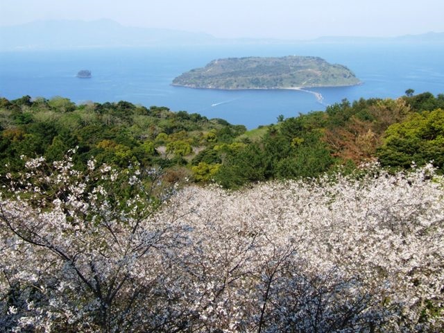
It is a mountain of 215 meters above sea level from which the sandbank of Chiringajima Island can well be seen.In addition, there a release stand of a hand glider, so it is also popular for its hang glider....
Sakurajima Lava Nagisa Promenade
KYUSHU
It is a promenade 3 km long on the lava zone spreading out from the west of Sakurajima Ferry Pier,which is called a live textbook telling the horror of the volcano eruption of 1914 that burnt down everything.Never skip this place....

KYUSHU
Yunohira Observatory is located at 373 meters above sea level, the fourth stage of Mount Sakurajimadake.Upside, mountains of Sakurajima can be seen; downside, the lave field, ferries arriving and departing Kagoshima Portat the foot of the mountain, the downtown of Kagoshima and the Kirishima Mountains can be seen.Therefore, it is really a view point of Sakurajima Island....
KYUSHU
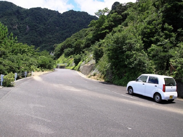
Seiburindo is a 12-kilometer road in the west of the island where visitors may see different forestsfrom the ones in Yaku cedar and also watch wild animals such as monkeys and deer and so on.Oko Waterfall is not only the biggest waterfall on the Yakushima Island but also in Kyushu with its 88-meter fall.Both the size and the quantity of water are perfect.It is also to reach the basin of waterfall....
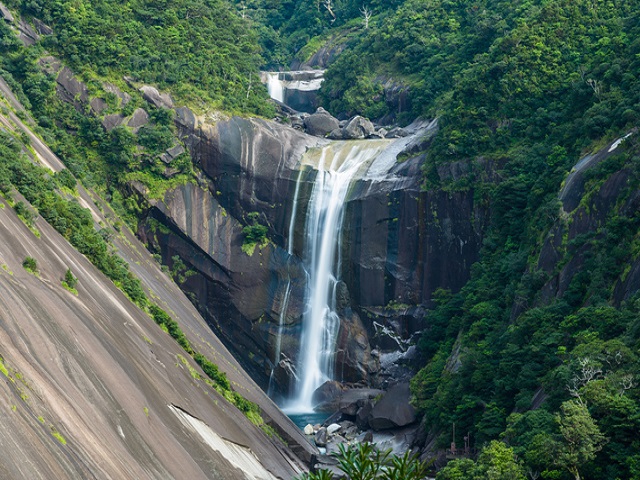
KYUSHU
It falls from the top of a big granite, whose fall is 80 meters.Though it cannot be seen from the distance, it is really a picture of water contrasted to the granite....
OKINAWA
It is a water of the greatest drop (about 55 meters) in Okinawa Prefecture,located at the upper part of the Hinai River, the Funaura Port which is 2.5 km away from the Uehara Port.It takes 40 minutes by canoe or 50 minutes by trekking to get to the top of the waterfall.What can be seen on the top of the waterfall is the mountain, the river and the sea in Iriomote Island.It is one of few spots to s...
OKINAWA
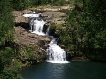
The two waterfalls are at the upper side of Urauchi River, the longest river in Okinawa Prefecture.A sightseeing boat is used as a jungle cruise from the boarding spot near the entrance of the riverto the Gunkaniwa Rock (Destination: 8 km upward from the boarding spot), then walking to the waterfall.A promenade is built from the Gunkaniwa Rock to the Maryudu Waterfall or to the Kanpire Waterfall,w...


